
Discover Benson’s Incredible Hiking Trails!
Discover Benson’s hiking trails, which offer diverse landscapes of beauty, combining the allure of desert landscapes, the serenity of grassy plains, and awe-inspiring mountain terrain. All are surrounded by Arizona’s famous “Sky Island” scenic views. Benson offers a variety of hikes that get you out on the trail to enjoy the surroundings. From gentle sloops to challenging climbs, you can find the right trail for your next hike regardless of your hiking experience.
Hikes at Kartchner Caverns State Park – Whetstone Mountains
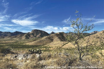
2.9 Mile Loop – Easy
Loop trail takes you to Kartchner Caverns State Park with a short detour to Mountain Viewpoint. Well-maintained and well-marked, with benches to rest along the way. Rocky sections – sturdy footwear and hiking poles are recommended. Parking is available at the trailhead. Fee Required.
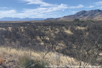
3.4 Mile Loop – Moderate
An addition to the previously existing Foothills Loop trail. It experiences a gentle yet steady elevation gain until reaching the saddle, indicating the trail’s halfway point. There are several wash crossings, so please be alert during summer monsoon storms. There are several benches along the way, but shade is sparse along most of the trail. Fee Required.
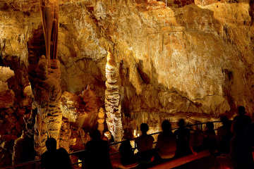
.5 Miles – Moderate – Out & Back
Hike underground! All tours are led by a trained guide; no self-guided tours are available. Various tours are scheduled daily. It is recommended that tours be booked as far in advance as possible to ensure availability. Fee Required
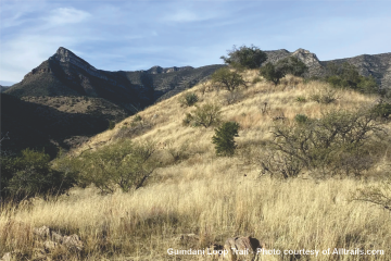
4.2 Mile Loop – Moderate
The trail is well-marked and easy to follow but be prepared for limited shade, steep sections with loose rocks, and running creeks to cross. You will be rewarded with lovely views of canyons. Sturdy footwear and hiking poles are recommended. The trailhead has parking and restrooms. Fee Required.

9.3 Mile – Hard – Out & Back
The first section is difficult to navigate, but there are cairns to help find the way. After a short scramble up some rocks, the trail runs through grasslands and is easier to follow. Farther up the canyon, the trail crosses a seasonal creek several times. Follow the cairns to keep to the trail. The trail climbs and winds up the canyon to the saddle. There are views of Benson and the community of Mescal from the saddle. Fee Required.
Easy Hikes in the Texas Canyon Nature Preserve
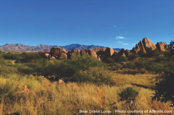
.9 Mile Loop – Easy
The Bear Grass Loop is an excellent hike for people who are new to hiking, have limited mobility, or are hiking with their families. This trail is also perfect for a short hike with stunning scenery. You will see rock hallways, balanced boulders, and views of the seasonal pond surrounded by cottonwood and mesquite trees. The trail is wide and mostly flat. The trail was built to make it easier for Tohono O’odham basket weavers to collect bear grass, yucca, and other raw materials for their baskets. Fee required.
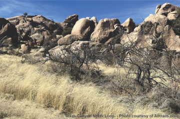
1.3 Mile Loop – Easy
The northern loops of the trail revolve around two remarkable rock formations adorned with spires and boulders, leading to a pond that appears only during the seasonal period. There are fascinating spots such as the Anniversary Rock, which resembles a couple kissing, a giant Stetson hat, a teapot, and numerous other shapes. Fee required.
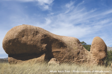
1.9 Mile – Easy – Out & Back
Some parts of the trail are overgrown, so having a map is essential. From the trailhead, you will hike through the lowlands for about 3 miles. Once through the lowlands, you will face a continuous uphill climb. The ascent has no switchbacks and continues for about 3.5 miles until you reach the camp. The terrain is rocky so footing can be tricky. Recommended for experienced hikers. You will start in the Rincon Mountain Wilderness area and hike into the Saguaro National Park.
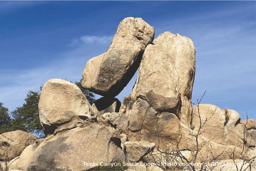
3.2 Mile Loop – Easy
The Texas Canyon Nature Preserve’s south loops offer a premier destination where you’ll wind through rock formations, cross grasslands dotted with boulders, climb to ridgetops with incredible vistas, and get a chance to see the preserve’s wildlife–like hawks, owls, deer, javelinas, coyotes, lizards, and snakes.
Serious Hikes in Happy Valley – Rincon Wilderness
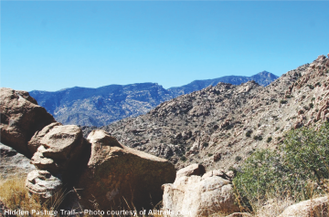
7.2 – Moderate- Out & Back
Park your vehicle in the large open “roundabout.” The trailhead starts along a fenced property and accessed from the second left dirt road. The fence can be opened to access the trail marker but close the fence behind you to avoid releasing livestock. The trail has serious elevation climbs. The final 1,200′ ascent has tight switchbacks and a steep grade. The stony summit has has great panoramic views. You will start in the Rincon Mountain Wilderness area and hike into the Saguaro National Park.
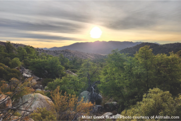
6.9 Mile – Hard – Out & Back
Generally considered a challenging route, it takes an average of 4 h 6 min to complete. This trail is excellent for hiking, and you’ll unlikely encounter many other people while exploring. The best times to visit this trail are December through May. You will start in the Rincon Mountain Wilderness area and hike into the Saguaro National Park.
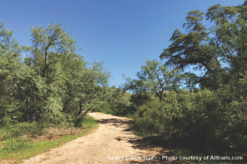
12.3 – Hard – Out & Back
Some parts of the trail are overgrown, so having a map is essential. From the trailhead, you will hike through the lowlands for about 3 miles. Once through the lowlands, you will face a continuous uphill climb. The ascent has no switchbacks and continues for about 3.5 miles until you reach the camp. The terrain is rocky so footing can be tricky. Recommended for experienced hikers. You will start in the Rincon Mountain Wilderness area and hike into the Saguaro National Park.
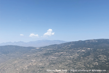
14.7 – Hard – Out & Back
Park your vehicle in the large open “roundabout.” The trailhead starts along a fenced property and accessed from the second left dirt road. The fence can be opened to access the trail marker but close the fence behind you to avoid releasing livestock. The trail has serious elevation climbs. The final 1,200′ ascent has tight switchbacks and a steep grade. The stony summit has has great panoramic views. You will start in the Rincon Mountain Wilderness area and hike into the Saguaro National Park.
